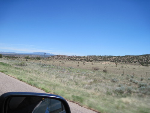
Visitors know New Mexico enjoys an eye-catching landscape — the state nickname “Land of Enchantment” burnished on its license tags (or plates, depending on your regional dialect) is no oversell. But what struck us more was the frequency of change in the landscape. The more familiar canyons and cliffs of Arizona aren’t quite here yet, but the New Mexican dells, dales, arroyos, vales, valleys, peaks, buttes and rises, along with fluctuations, almost by valley at times, in rainfall, vegetation and wildlife, underground water sources, altitude and geology, make for lovely and dramatic varying terrain.
Part of the surprise is that west from Texas into New Mexico, the landscape at first changes not at all. Here through our bug-stained windshield is the arrow-straightness of interstate 40 and dry, flat prairie.

But soon enough distant mountains shadow the skyline. If you’re intent on traffic (speed limit 75 mph) or keeping cool under a southern sun and escaping hynosis from the lull of hours passing, you may not notice them at first.

The geologic “ripples” slowly and steadily edge closer till they insist on being seen. The land insinuates itself into your awareness, serpentine.
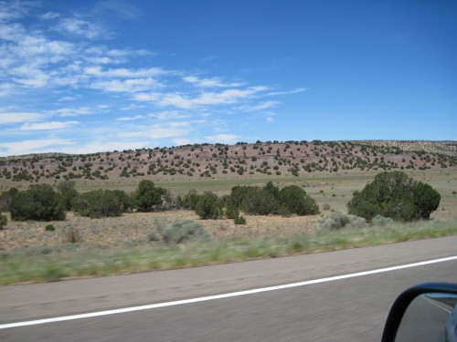
And by Tucumcari NM, the buttes start in earnest. Many like the one below are so etched by wind and heat and rain and time that they seem unreal, the work of a whimsical or apprentice set designer. Here, too, wet and dry stand side by side. As heedless easterners accustomed to the default of lush greenery and nearly endless water, we took to heart the endlessly repeated evidence of the vital importance of water here.

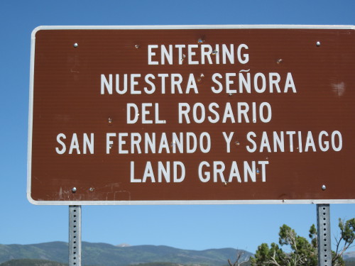
Part of the pleasure of New Mexico — for me at least — is the omnipresence of Spanish — in place names, on road signs, menus, shops and gas stations. Not that I actually know much Spanish — only a bare reading knowledge, along with some cognates from French (high school level) and Latin (badly self-taught).
Here Anglo-Americans like us can’t pretend the planet speaks only English — it obviously doesn’t, and places like New Mexico, just like Northern Vermont and New Hampshire with the proximity of Francophone Canada to the north, can serve as gentle and pleasant reminders — introductions to an accessible foreignness. Almost every American can point to a smattering of a dozen or so Spanish words they half-know, courtesy often of Hollywood and Tex-Mex cuisine and its less noble fast-food relatives. And Spanish — real Spanish — runs deep here.
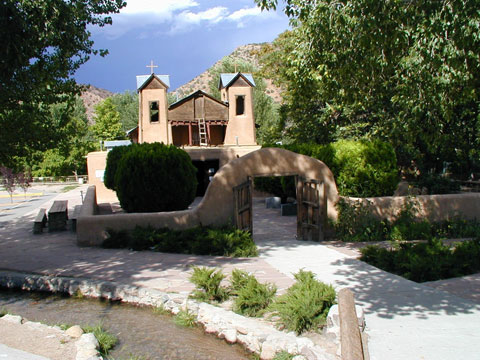
This greener region was part of the “weaving tour” we took, northeast from Santa Fe, through Española, from there to Chimayó, into the highlands and through hill towns like Truchas (elevation 8000 ft., rivalling the Grand Canyon), and on to Mora with its Tapetes de Lana, the trees so far holding onto their green in the growing heat of summer. And by “weaving” I mean quite literally the craft of weaving — my wife had mapped out in advance weavers and studios she wanted to visit.
In Chimayó we made a brief pilgrimage to El Santuario de Chimayó, a stop urged on us besides by one of the local Spanish weavers my wife and I visited. Wikipedia names the humble and beloved sanctuary and community church “the most important Catholic pilgrimage center in the United States.”

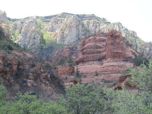
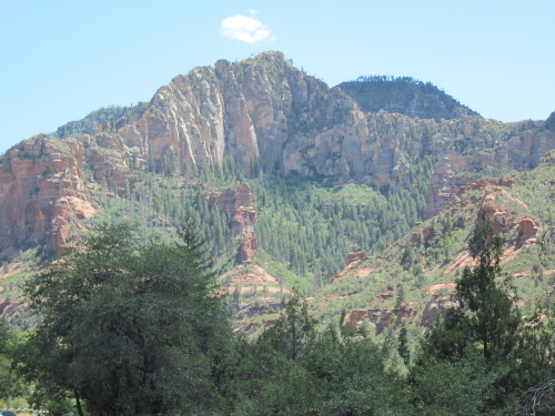
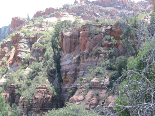
ARIZONA: OAK CREEK CANYON and NORTHERN SEDONA
After several days of exploring outward from our base of Santa Fe, which enjoys a very walkable and historic downtown, the Plaza, we drove on to Arizona. (With an eye for tourist dollars, Santa Fe developers overdid the adobe, with plenty of “faux-dobe,” as native cynics call it, nevertheless lending Santa Fe an admittedly distinctive look all its own. The endless shades of pink and beige and unnameable variants between them simply mirror the land they derive from.)

Friends in Sedona beckoned us south from the big state draw of the Grand Canyon, which would keep for the following day. This is a landscape that keeps whispering I have been here a long time, I am still here, and I will be here long after you are gone..
Sedona hogs most of the tourism for central Arizona, apart from Flagstaff as a portal to Grand Canyon, but a stunning preamble lies between Flagstaff and Sedona itself, along Oak Creek Canyon. Besides, whenever we could we like to get off interstates if mere distance traveled isn’t our main objective. So off interstate 17 and onto 89A takes you through these striking canyons.

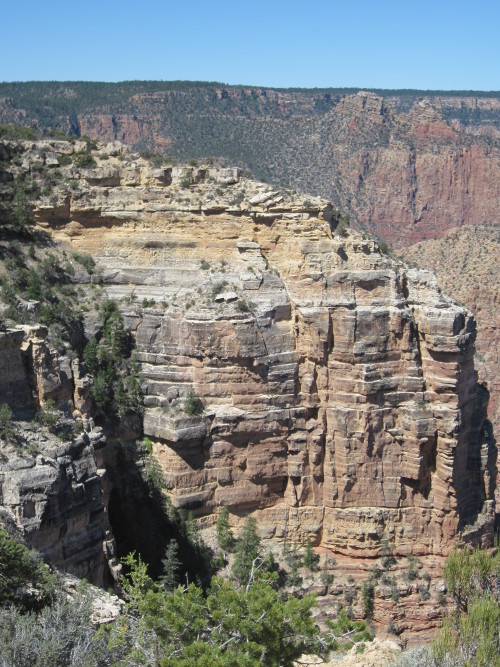
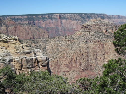
GRAND CANYON
Mather Point is the main overlook, the most photographed spot, a sort of “Grand Canyon Standard,” if one is needed. Yes, it deserves its primacy of place — and the crowds follow. But plenty of equally fabulous lookout points to the east deserve a stop, and draw far fewer visitors in comparison, making for a quieter, more meditative experience. (Our Sedona friends, and hotel staff as well, said to arrive at the south rim early in the morning. Good advice — we departed from the Canyon around 10:00 am, just when it seemed everyone else was arriving.)


NORTHERN ARIZONA, or (as we came to think of it) MARS …


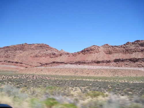
Here’s the environment around Rt. 89 again, the northern piece of it, west of Page, AZ and SE of Kanab, UT, well north of the North Rim of the Grand Canyon, though still called the Grand Canyon Highway, on its way through some wonderfully stark country. The image looks somewhat fuzzy until you realize you’re looking across a plain to a ridge some 30 miles away — the camera foreshortens the distance without clearly resolving the scale of what it captures.

And a mere six or seven miles up and out of the valley, forests take over again, once sufficient elevation — and rainfall — lifts them above the heat of the plain. A few miles further west into hills and we pass Jacob Lake Inn. The coolness as we drive by, windows down, is delightful.

Images: Santa Fe Adobe; El Santuario de Chimayo; all other images by the author.
